| Huslia Airport | |||
|---|---|---|---|
| IATA: HSL – ICAO: PAHL – FAA LID: HLA | |||
| Summary | |||
| Airport type | Public | ||
| Owner | State of Alaska DOT&PF - Northern Region | ||
| Location | Huslia, Alaska | ||
| Elevation AMSL | 213 ft / 65 m | ||
| Runways | |||
| Direction | Length | Surface | |
| ft | m | ||
| 3/21 | 4,000 | 1,219 | Gravel |
| Source: Federal Aviation Administration[1] | |||
Huslia Airport (IATA: HSL, ICAO: PAHL, FAA LID: HLA) is a state-owned public-use airport located one nautical mile (1.85 km) east of the central business district of Huslia,[1] in the Yukon-Koyukuk Census Area of the U.S. state of Alaska.
Although most U.S. airports use the same three-letter location identifier for the FAA and IATA, this airport is assigned HLA by the FAA[1] and HSL by the IATA[2] (which assigned HLA to Lanseria Airport in Lanseria, South Africa[3]). The airport's ICAO identifier is PAHL.[4]
Contents |
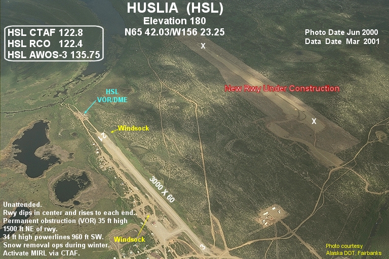
Huslia Airport covers an area of 203 acres (82 ha) at an elevation of 220 feet (67 m) above mean sea level. It has one runway designated 3/21 with a gravel surface measuring 4,000 by 75 feet (1,219 x 23 m).[1] This replaced the former runway which had the same designation and measured 3,000 by 60 feet (914 × 18 m).[5]